
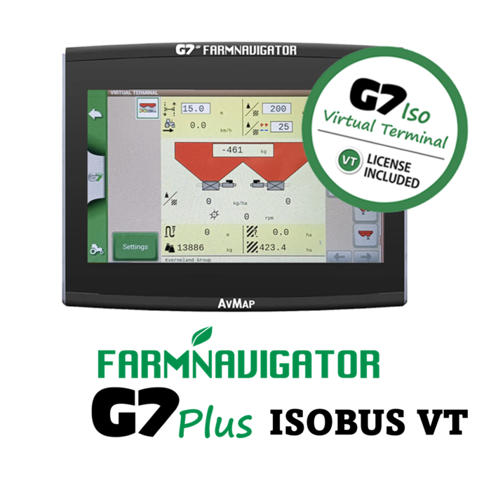
Make your tractor ISOBUS!
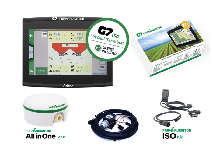
Our Premium Pack GPS system from Farm Navigator. A neat package consisting of an ALL IN ONE RTK GPS/GNSS receiver, G7 Screen with field guidance and supplied with a Tractor ISOBUS® cable with a female ISOBUS®connector which can be mounted at the back of the tractor. Therefore, you have just made your non ISOBUS® tractor ISOBUS®. You can connect any ISOBUS® implement to the G7 and your implement control page will appear on the Screen. The FarmNavigator GPS will then control the implement. AUTO STEERING can be added using the MDU G5 or MDU G4 steering system. We prefer the MDU G5 as it comes complete with steering wheel.
The monitor is exactly the same casing as the rest of the G7 range. It is taken from the marine division of AvMAP. It is water proof (made to be on the deck of a yacht in all weathers), and it has a market leading display which allows a full view from any angle and sunlight changes.
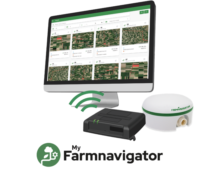
Telemetry
Telemetry is the automatic measurement and wireless transmission of data from remote sources.
This means, if you select our service package, Cleveland specialists can remote access your system, help you with operation or programming issues from our location. Saving time and money. Ask us for details.
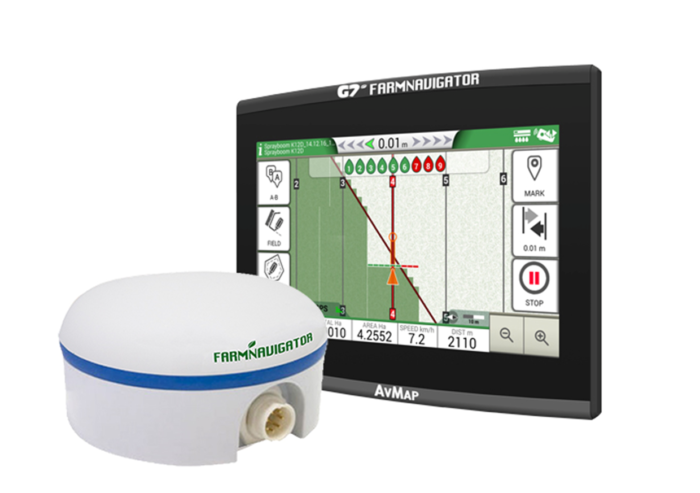
What is the RTK ALL in ONE?
Ready to connect
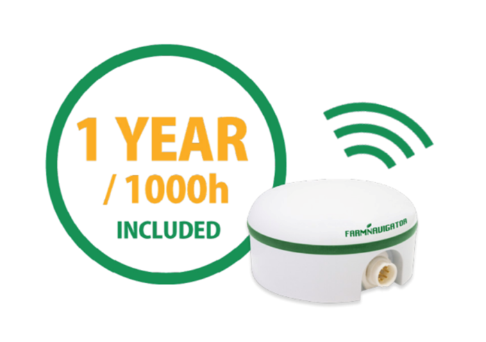
GSM Connectivity included all over Europe
All in One RTK includes 1 YEAR / 1000 hours of connectivity, this means you do not have to worry about the Telecom contract. GSM Connectivity is included all over Britain & Europe, no need for a SIM card.
Connectivity is supported in: Andorra, Austria, Belgium, Bulgaria, Cyprus, Croatia, Denmark, Estonia, Finland, France, Greece, Germany, Hungary, Iceland, Ireland, Italy, Latvia, Liechtenstein, Lithuania, Luxembourg, Malta, Netherlands, Norway, Poland, Portugal, Czech Republic, Romania, UK, Saint-Marin, Spain, Slovakia, Slovenia, Sweden, Switzerland.
For other areas, please contact us.
An annual renewal is approximately £235 + VAT
A 3 year renewal is approximately £425 + VAT
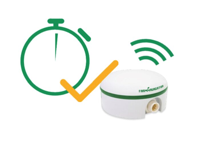
Easy to install, NTRIP ready
RTK corrections made easy
It is ready to be used with just a simple registration on line. You just have to choose your RTK service (please contact us to find out whether there is a free RTK service in your area).
- Embedded and pre-configured NTRIP Client to receive RTK connection via the internet, compatible with NTRIP services worldwide. Tested with 20+ different NTRIP casters.
- Automatic firmware update over the air when a new release is available. No actions required by the user.
What is in the kit:
- The G7 Monitor ~ high definition touch screen
- A high quality touch RAM mount with window attachment
- ISOBUS tractor cable with auxiliary connection cable
- VT & TC Licenses unlocked
- Our RTK All in ONE GNSS receiver
- All cables pre wired
We will even pre-program the G7 to your requirements, so it is ready to go when you receive it. We can, of course, come to your location to install it.
Get to work in just few steps!
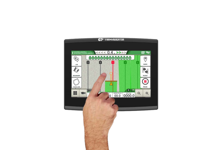
The FARMNAVIGATOR software, perfected for over 15 years, also thanks to customer suggestions, offers advanced functions on a simple farmer-friendly interface, with large and intuitive buttons.
In the field view you can keep an eye on all the most important data and everything is within reach thanks to the collapsible menus.
You can use multiple finger gestures on the display to scroll menus, or to zoom in and out the field view by stretching and pinching with two fingers.
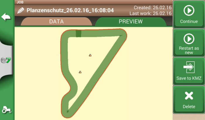
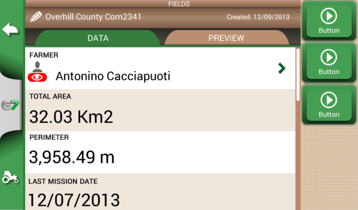
Start creating your fields’ database:
- measure your field boundary
- calculate the area
- and save the position of obstacles or soil samples.
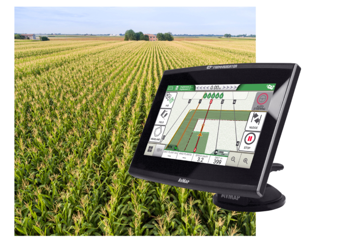
Satellite Assisted Parallel Guidance
Choose the guidelines for your activity and follow the guidance cursor to correct your driving.
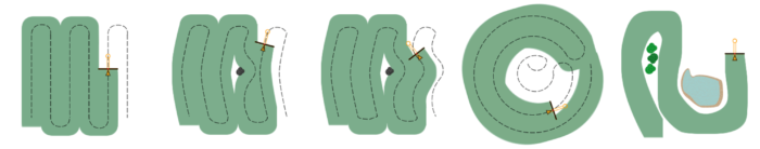
- Choose among A-B parallel lines, identical curves, adaptive contour or pivot guidelines.
- Save and recall guidelines for further activities in the field.
- Make sure the guidance line is always visible through the circle on the top of the smart cursor. The cursor will help you understand the tractor turn radius, to quickly correct your steer.
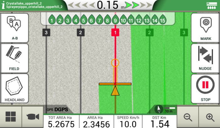
Headland Management
When starting a job, you can create a headland within the field boundary, based on your working width.
- The Headland Management function is very useful for irregular fields such as triangular fields. When active, the Automatic Section Control will close the sections of the implement at the headland border, the headland can be worked at the end, avoiding unnecessary overlaps.
- The headland function can be used with A-B parallel guidelines, identical curves and adaptive contour guidelines.
Jobs Database
Farmnavigator records data for each Job: farmer, activity, field, implements used, products used, worked area, total time etc.
- Manage your data: fields and jobs can be exported to Google Earth as .kmz files.
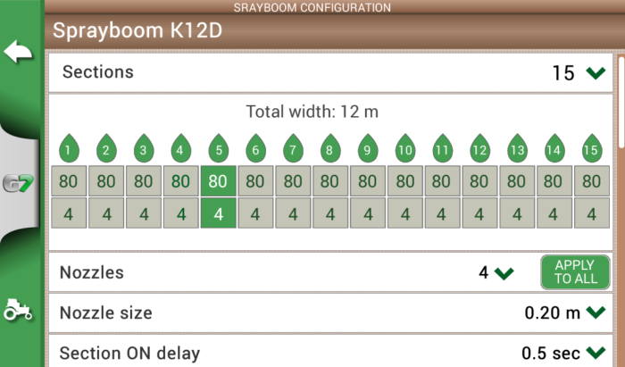
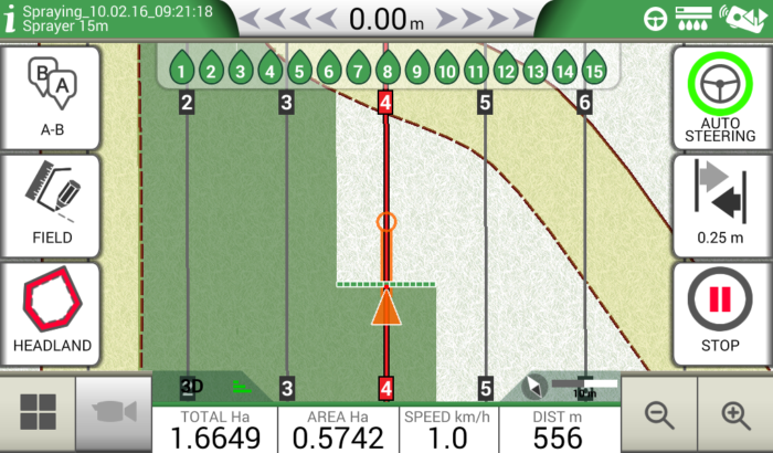
Section Control
Configure and control your implements:
- Create a profile for each implement and activity e.g. seeding, fertilizing, or spraying: set the working width, or the number of boom sections and their individual width.
- Then choose a profile and get indications for manual boom switch control to start reducing costs and protecting the environment.
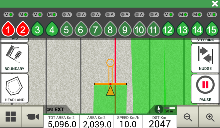
Automatic Control
Connect a compatible controller to G7 Ezy / G7 Plus Farmnavigator for higher precision and greater productivity.
- Farmnavigator calculates the exact treated area and controls automatically the boom sections based on the position received by the DGPS antenna.
- You can still close or open manually a section from the display forcing the automatic control.